Introduction – Bass Lake Road – Present and Future
Kathy Prevost
In our September Bass Lake Bulletin we learned about the history of Bass Lake Road and the specific plans which have spurred both the residential and commercial growth in the Bass Lake area we see today. This month we will talk about the current impacts on Bass Lake Road and what the future holds. For instance, what can the residents of the northern end of Bass Lake Road beyond Serrano Parkway expect since there have not been any road or safety improvements made thus far nor are there any planned in the near future.
While reading last month’s bulletin article you may have noticed the General Plan mentioned and wondered exactly what that is and how does it relate to what is happening in the Bass Lake area today.
As you are aware, El Dorado Hills is not incorporated and we are primarily represented by our District 1 County Supervisor, John Hidahl, on the five person Board of Supervisors. However, part of the southern end of Bass Lake Road is in District 2 and is represented by Supervisor Shiva Frentzen. The northern end of Bass Lake Road and Green Valley Road is represented by District 4 Supervisor Lori Parlin.
California state law mandates that the county must operate under a current General Plan which is a long-term blueprint for the community’s vision of future growth and updated at least every 10 years. This plan is to include land use, open space, conservation, housing, circulation, noise and safety elements. El Dorado County last adopted their General plan in July of 2004 and the most current amendment was approved by the Board of Supervisors in September 2019.
In 1981, the Board of Supervisors requested the formation of the Area Planning Advisory Committee (APAC) to provide public input for the development of the County’s new plan for the El Dorado Hills and Salmon Falls areas. In December of 1983, the El Dorado Hills/Salmon Falls Area Plan and Development Policies were approved.
Among the many goals and policies of the Area Plan was a desire to retain the rural atmosphere while striving for a well-balanced community, retention of a feeling of open space and an integrated comprehensive community plan that insured functional healthy and aesthetically pleasing land uses. The El Dorado Hills and Bass Lake Hills Specific Plans strove to be consistent with the Plan.
Each Specific Plan provided a comprehensive framework for the future development of the planned area including land-use densities, how land was to be developed and the public facilities and services necessary to support the allowed development.
John and I hope you enjoy reading our collaborative efforts for this month about how the Bass Lake area is being developed for the present and future.
Bass Lake Road – Present and Future
Kathy Prevost, and John Davey
Bass Lake Road – Present – Capital Improvement Program (CIP) and Traffic Impact Fees (TIM)
General Plan Policy TC-Xb requires the County to prepare a 20 year Capital Improvement Program (CIP) plan which is updated each year. It identifies and plans for necessary improvements to ensure the safety and reliability of the County’s transportation infrastructure.
The process includes identifying, prioritizing and developing funding for projects programmed in the CIP. General Plan Implementation Measure TC-A requires the program to be updated to specify the expenditures for roadway improvements within the next ten years.
Major updates to the CIP for roadway projects in the Western Slope area and the Traffic Impact Mitigation (TIM) Fee Program are undertaken every five years, in coordination with the five-year major review of the General Plan.
The 2018 CIP Book was adopted by the Board on June 26, 2018. The 2018 CIP document (and prior years) is posted on the County website at: https://www.edcgov.us/Government/dot/Pages/cip.aspx
A major revision of the CIP and TIM Fee Program was adopted on December 6, 2016, and went into effect on February 13, 2017. When the major update was performed in 2016, it was based on the belief there would be significant State and Federal grant revenue available. This resulted in decreased TIM Fees for almost all zones and land use types. By law, the General Plan requires a fully-funded TIM Fee program.
An annual minor revision to the TIM fees was approved by the Board of Supervisors May14, 2019 and was effective July 15, 2019.
Subsequently the grant revenue assumptions were found to be overstated and the TIM Fees needed to be updated. The typical time frame to implement a major update to the CIP and TIM Fee programs is approximately two years. At their September 17, 2019 meeting the Board of Supervisors requested that the Department of Transportation (DOT) perform a full update to the TIM fee program.
DOT was directed to have staff perform an expedited 2020 major TIM Fee update and level of public outreach with no interim fee adjustment. Additionally the hiring of temporary additional administrative staff was approved. It is anticipated that it will be complete by November 2020. Current TIM Fee rates and supporting documents are located here.
General Plan Policy TC-Xb is stated in the Transportation and Circulation Element on page 69. General Plan Implementation Measure TC-A is stated in the Transportation and Circulation Element on page 76.
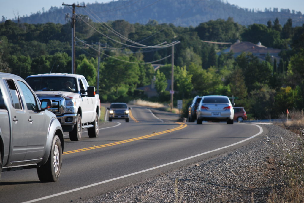
Highway 50 and Bass Lake Road improvements – 2019 CIP
US 50WB Bass Lake Road to Silva Valley Parkway auxiliary Lane – construction – 2027/28
CIP No. 53117 – projected costs: $5.8 million
US 50 and Bass Lake Road interchange – construction – 2028/29
CIP No. 71330 – projected costs: $6.2 million
US 50 EB and Bass Lake Road off ramp signalization – 2020
CIP No. 73367 – projected costs: $1.1 million
Bass Lake Road four lane expansion – US 50 north to Serrano Parkway- construction -2037/38
(Added to the 2018/19 CIP in 2017, REMOVED from the 2019/20 CIP in 2018)
CIP No. 72BASS – projected costs: $14.2 million
US 50 EB Bass Lake Road to Cambridge auxiliary lane – construction – 2037/38
CIP No. GP148 – projected costs: $9.4 million
Country Club Drive extension Tong Road to Bass Lake – construction – 2023/28
CIP NO. 71361 – projected costs: $13.2 million
Country Club Drive extension Silva Valley to Tong Road – construction – 2023/28
CIP No. 71362 – projected costs: $6.9 million
Country Club Drive extension El Dorado Hills Boulevard to Silva Valley Parkway – 2028/38
CIP No. 72377: projected costs: $11.4 million
Silver Springs Parkway to Bass Lake Road – construction – 2019/20
CIP No. 76108 – projected costs: $9.4 million
Madera Way – Right Turn Pocket – part of the Silver Springs Parkway CIP Project
Bass Lake Road – Present: Specific Plans
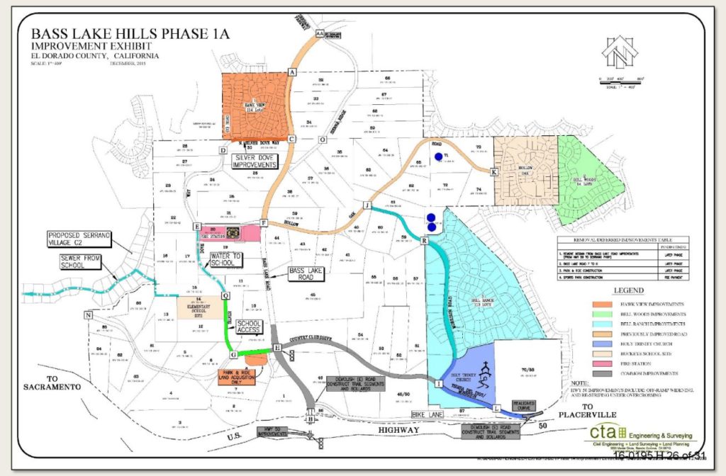
Bass Lake Hills Specific Plan 1A and Phase 2 Projects (BLHSP)
The Country Club Drive realignment project grading began in September, 2019. Ultimately Country Club Drive (aka Tierra de Dios) will be redirected to follow the general alignment of City Lights Road to meet Bass Lake Road. The old Country Club Drive will be converted into a bike trail.
A new north south roadway named Morrison Road will be constructed linking Country Club Drive to Hollow Oak Road. This improvement is not currently listed in either the CIP or TIM fee programs but is a component of the BLHSP and will be triggered by the completion of the final map creating the 25th lot in the Bell Ranch project.
Bass Lake Road will be reconstructed as a two-lane divided road with a bike trail from Highway 50 to just north of the intersection of the new Country Club Drive intersection consistent with the Rural Region boundaries.
Background
A little more than a year after adding the four lane expansion of Bass Lake Road from Serrano Parkway to Highway 50 to the CIP, DOT proposed to remove the expansion from the CIP as part of their annual review. Instead they wished to add the east bound Bass Lake Road /Highway 50 off ramp signalization project listed as CIP Project No: 73367.
The reasoning was sourced to the Rural Region versus Community Region lines on a map of the area. Bass Lake Road from Highway 50 to the proposed realigned Country Club Drive signalized intersection is identified as being in a Rural Region, while Bass Lake Road north of the proposed realigned Country Club Drive signalized intersection is in the El Dorado Hills Community Region.
The Highway 50/Bass Lake Road interchange improvements were intended to be
provided by the developers of the BLHSP Phase 1A Projects and the BLHSP Public
Facilities Financing Plan (PFFP). The
new Development Agreement negotiated in 2016/17 by the El Dorado County
Director of Planning effectively shifted the majority of the costs of this east
bound Highway 50 off ramp signalization part of the project to El Dorado
County:
Developer funding – $240,000.00
County Traffic Impact Mitigation (TIM) Fee Funding – $910,000.00
Highway 50 at Bass Lake Road currently has a Level Of Service (LOS) rating of E. In a Rural Region, LOS E is the trigger for required road capacity improvements. In a Community Region, LOS F is the trigger for those same required road capacity improvements.
Therefore, the Highway 50 signalization project will begin in 2020 and the
four lane expansion of Bass Lake Road from Highway 50 to Serrano Parkway will
be removed. This is despite the fact the
funding, planning, design, and construction for the four lane expansion of Bass
Lake Road wasn’t planned until somewhere in the future 2028/2038 time frame.
None of the BLHSP improvements for Bass Lake Road are intended to be
constructed north of Serrano Parkway. Both the 1988 EDHSP and the BLHSP
Environmental Impact Reports (EIR) and subsequent development projects in the
area after 1988 were all approved with the belief that Bass Lake Road
ultimately would require a four lane expansion.

The 1989 EDHSP Final Environmental Impact Report (FEIR) Figure 7-21 2010 Plus Project with Mitigated Roadway Network identifies Bass Lake Road as a four lane divided arterial road. This FEIR was certified by the County of El Dorado Board of Supervisors as a part of the approvals for the EDHSP.
However, the EDC DOT has explained recently that since projected development projects have either been reduced in density, or not realized since 1988, that the existing Bass Lake Road conditions as well as impacts from approved future projects no longer meets the need for capacity improvements. Bass Lake Road has been deemed adequate for existing conditions in terms of average daily trips as well as the cumulative volume of daily trips added by future approved development in the area.
In terms of the safety features of Bass Lake Road, DOT explains that the Silver Springs Parkway extension to Bass Lake Road, the Country Club Drive re-alignment/signalization at Bass Lake Road and the east bound Highway 50 and Bass Lake Road off ramp signalization, will satisfy both existing and future planned safety needs as projected in the 20-year CIP.
https://edhapac.org/wp-content/uploads/2018/03/BassLakeHillsSP.pdf
Phase 1A
Bell Woods
A 54 lot single family home project in Cameron Park located at the eastern end of Hollow Oak Drive east of the Laurel Oaks Village in El Dorado Hills. It is currently under construction.
Bell Ranch
A 113 lot single family home project in El Dorado Hills located at the northern end of Tierra De Dios Drive. It is currently under construction.
Hawk View
A 114 lot single family home project in El Dorado Hills located at Hawk View Road along the western side of Bass Lake Road. It is currently under construction.
Phase 2
Bass Lake North

Bass Lake North is in the Bass Lake Hills Specific Plan and immediately adjoins Sienna Ridge Road and the Bridlewood Canyon development. The developer of Bass Lake North has requested consideration to amend the Conditions of Approval for the 2017 approved Tentative Map which requires them to build a much anticipated 100 space Park and Ride lot. They would prefer to construct only 50 spaces because of the cost burden.
When the 38.578 acre 90 dwelling project was granted approval in January of 2017 by the Board of Supervisors, a request was made by Supervisor Frentzen that they also complete the Bass Lake Road Bike Trail from Hollow Oak to Highway 50 as one of the Conditions of Approval. This project is also conditioned to purchase the right-of-way and complete North Silver Dove which will connect Bass Lake Road to Sienna Ridge Road.
Additionally, like the BLHSP Phase 1A projects, the Bass Lake North project is responsible for parts of the road improvements from north of the realigned Country Club Road (aka Tierra de Dios) to Highway 50, the Country Club realignment as well as the intersection at Bass Lake Road.
The Bass Lake North developer is asking for an extension of their Tentative Map’s approval because it took them two years to complete the annexation into EID through the Local Agency Formation Committee (LAFCO). EID would not accept the Facility Plan Report for review until the property was annexed.
El Dorado Hills Specific Plan (EDHSP)

Serrano Village J6
Village J6 is a 148 lot single family home project in El Dorado Hills located south of Bass Lake bordered by Sienna Ridge Road to the west and Bass Lake Road to the north. It is currently under construction with three entrances completed: two on Sienna Ridge Road opposite the Sienna Ridge Shopping Center and one on Bass Lake Road east of Serrano Parkway named Whistling Way.
Serrano Village J7
Village J7 will be the final Village built as part of the Serrano El Dorado Development in the Bass Lake Area by Parker Development. Other Serrano interior villages are still under construction. It is approved for 71 multiplex homes but is currently seeking approvals for a revised 65 single-family residential lots project on 9.86 acres that adjoins Bridlewood Canyon and the Bass Lake Overflow.
As part of the Conditions of Approval, they are required to design the grading and improvement plans for the ultimate alignment of Bass Lake Road. Also, they are to sign a deferred frontage agreement with the county and deposit their share of the improvement cost for future construction of the realignment of Bass Lake Road prior to recordation of the first small lot final map within the Village.
The project has been designed consistent with the ultimate four lane alignment of Bass Lake Road. However, the DOT does not see the need for these roadway improvements within the life of the current General Plan. The DOT finds that current traffic conditions, along with future projections, do not warrant the long-promised improvements to northern Bass Lake Road.
Additionally, the DOT and the County Planning Department cite the decrease in actual residential build-out from the higher limits of the approved EDHSP, and the BLHSP. Therefore, construction of the ultimate Bass Lake Road improvements is not required of Village J7.
https://edhapac.org/wp-content/uploads/2017/10/ElDoradoHillsSP.pdf
Bass Lake Road – Future
Silver Springs

Units 1 – 3 of the Silver Springs residential development were conditioned to construct Silver Springs Parkway from Green Valley Road south to Bass Lake Road. Unit 1 of this project is currently under construction. This project will also provide a new connecting road from the development (“Arapahoe Drive”) directly onto Bass Lake Road at roughly the current Hill Road alignment north of Magnolia Hills Drive and south of Woodleigh Lane.
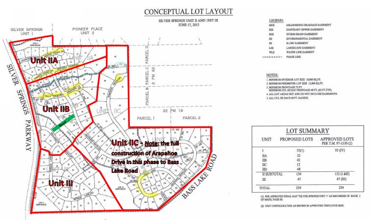
Included in the Conditions of Approval (COA) of the Silver Springs project as COA #37:
The subdivider shall revise the street plan to connect to the Vista Verde project (TM97-1342) at a mutually agreeable location, subject to the approval of the Planning Director and the County Engineer (see project info below).
Silver Springs Parkway
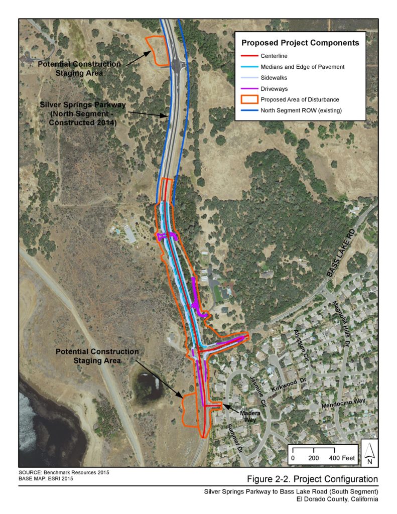
This project dates back to the 1980’s and was originally planned as a realigned Bass Lake Road to serve the Silver Springs residential development project and provide a straighter alignment to Green Valley Road. Later it was renamed Silver Springs Parkway and the northern section was partly constructed in 2014, with a signalized intersection at Green Valley Road to the east of Pleasant Grove Middle School. The road was planned as a divided four lane arterial road with full curbs, sidewalks and bicycle lanes.
This was later changed to a two lane divided road keeping the sidewalks and bicycle lanes while DOT retained the four lane alignment right of way for future construction. Unfortunately, the sidewalks and bicycle lanes end at the connection to Bass Lake Road so the pedestrian and bicycle facilities are isolated to Silver Springs Parkway and Green Valley Road. The final southern extension to Bass Lake Road is scheduled for construction in 2020.
According to the 2018 El Dorado County CIP Book, the remaining quarter mile of the southern connection to Bass Lake Road is expected to cost over $9 million dollars. The southern connection will provide a new three way stop sign controlled intersection to eliminate the 25MPH curve in Bass Lake Road at Sandhurst Hill Road as well as provide a right turn pocket on northbound Bass Lake Road and Madera Way.
Bass Lake Estates

This project consists of 36 single family homes north of Magnolia Hills Drive and south of Woodleigh Lane.
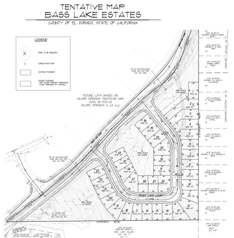
It was approved with a condition that left turn movements were eliminated at the southern connection of Trout Lake Court to Bass Lake Road. However, instead of the approved condition, the project owners are marketing the property with a possible alternate 27 lot configuration and two separate non-internal connecting road intersections to Bass Lake Road. Market materials suggest that County Planning Staff supports the alternate plan of 27 lots.
The Trout Lake Court intersection(s) on the south side of Bass Lake Road are a few hundred feet away and across from the proposed Silver Springs Unit 2 (“A Street/Arapahoe Drive”) road connection on the north side of Bass Lake Road. This results in three new intersections on Bass Lake Road between Magnolia Hills Drive and Woodleigh Lane all within a few hundred feet of each other on a hill with a slight curve on Bass Lake Road.
Sierra Sunrise
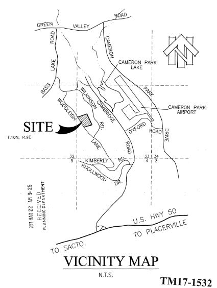
A 7 single family home project on Woodleigh Lane that has no requirement to improve Bass Lake Road.
Rancho Tierra
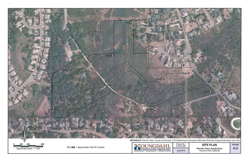
An 84-single family home development that will connect Woodleigh Lane in Cameron Park to Great Heron Drive in the Woodridge Village in El Dorado Hills. It will provide connectivity to Summer Drive and Bass Lake Road via Madera Way.
PA15-0008 Richland
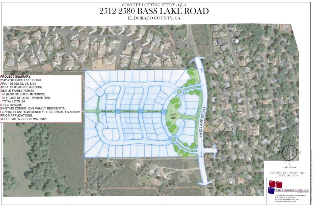
Verde Vista is a seemingly abandoned 84-lot single family home project on Bass Lake Rd at Gateway Drive. There are two road connections to Bass Lake Road and an expected internal road connection to the Silver Springs Development.
Bass Lake Regional Park
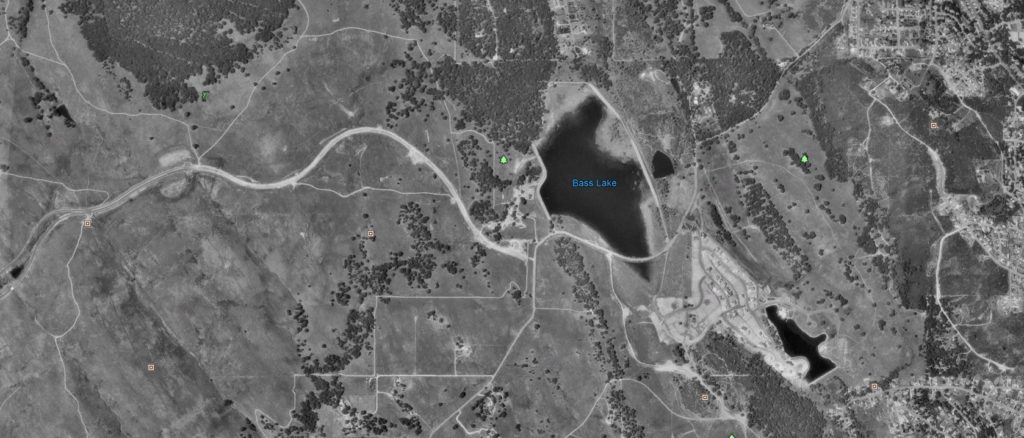
The El Dorado Hills Community Services District (EDHCSD) plans to build a regional park at Bass Lake by combining the 142 acre Bass Lake property they purchased from Rescue Union School District with several other properties in the immediate area.
The other properties they are purchasing or have purchased are 16 acres from the El Dorado Irrigation District, 42 acres from El Dorado County and 12 1/2 acres from Parker Development. The 12 1/2 acres is owed to the community by Parker development for parkland as part of the EDHSP.
EDHCSD plans to make Bass Lake Park the largest park and recreational project in the area ultimately spanning more than 200 Acres. The initial plans include the addition of lighted sports fields and courts, a full disc golf course on the north east side of Bass Lake and a trail system that will provide safe multi-use trails connecting to other existing and planned trails in the area.
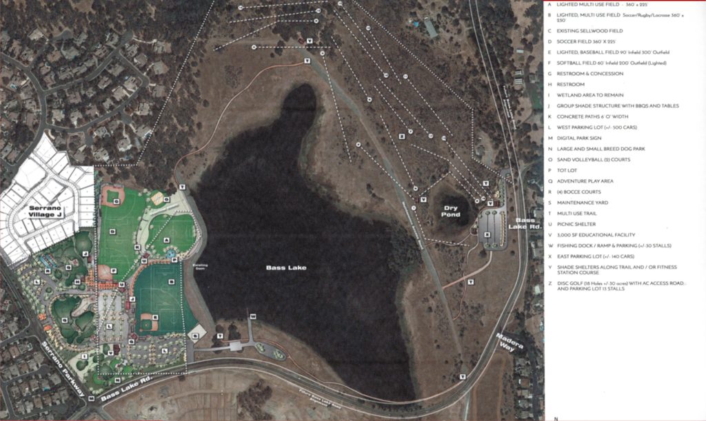
Plans include a fishing dock, group shade structures with BBQs and tables, a large and small dog park, sand volleyball, a Tot lot, and bocce ball courts. There are also plans for picnic shelters with shade shelters along the trails and or a fitness station course. Included as well would be a 3000 square-foot educational facility and boardwalk along the shoreline on the south side of Bass Lake as well as a 500 car lighted parking lot.
A 100 car lighted parking lot would be located on the north east side of Bass Lake near the disc golf course. Currently, the EDHCSD is working on a traffic study with El Dorado County because they would like to place the north east entrance to the park adjoining Silver Springs Parkway. Two western entrances are proposed with one on Serrano Parkway opposite Preston Way and the second on Bass Lake Road using the current EID entrance.
At the present time, these plans do not include any enhancements to Bass Lake Road such as traffic signals, stop signs, bike trails or pedestrian crossings with the exception of a section of sidewalk on the north side of Bass Lake Road from Serrano Parkway to roughly the EID property entrance.
Currently, the EDHCSD is working with Parker Development on the 12 ½ acre parkland dedication owed from the 1988 EDHSP at Village Lot H. Construction could possibly begin in 2020 as Phase 1 of the Bass Lake Regional Park.
Commercial Development
Sienna Ridge Shopping Center
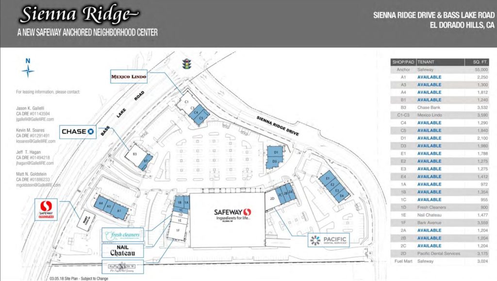
Located at the intersections of Bass Lake Road and Serrano Parkway/Sienna Ridge Road, the Sienna Ridge Center will be roughly 100,000 square feet and is anchored by a Safeway Grocery store with a fueling station. Safeway is expected to open in early 2020. More tenants are expected to follow in the second quarter of 2020.
The announced tenant list so far consists of Bark Avenue Pet Supplies, Chase Bank, Fresh Cleaners, Great Clips, Nail Retreat, Pacific Dental Services, Sourdough & Co, Jon & Bon’s Yogurt Shoppe, and Mexico Lindo.
Commercial Property – Corner of Bass Lake Road and Green Valley Road
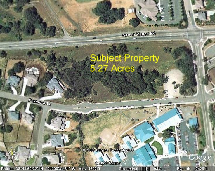
The 5.27 acre undeveloped commercial parcel is bordered by Foxmore Lane on the south, Green Valley Road to the north and Bass Lake Road to the east. Green Valley Elementary School is immediately across Foxmore Lane and the Glenview Apartments are across Bass Lake Road. The property has previously been marketed for sale and development.
Proposed Costco & EDH52 Commercial Site
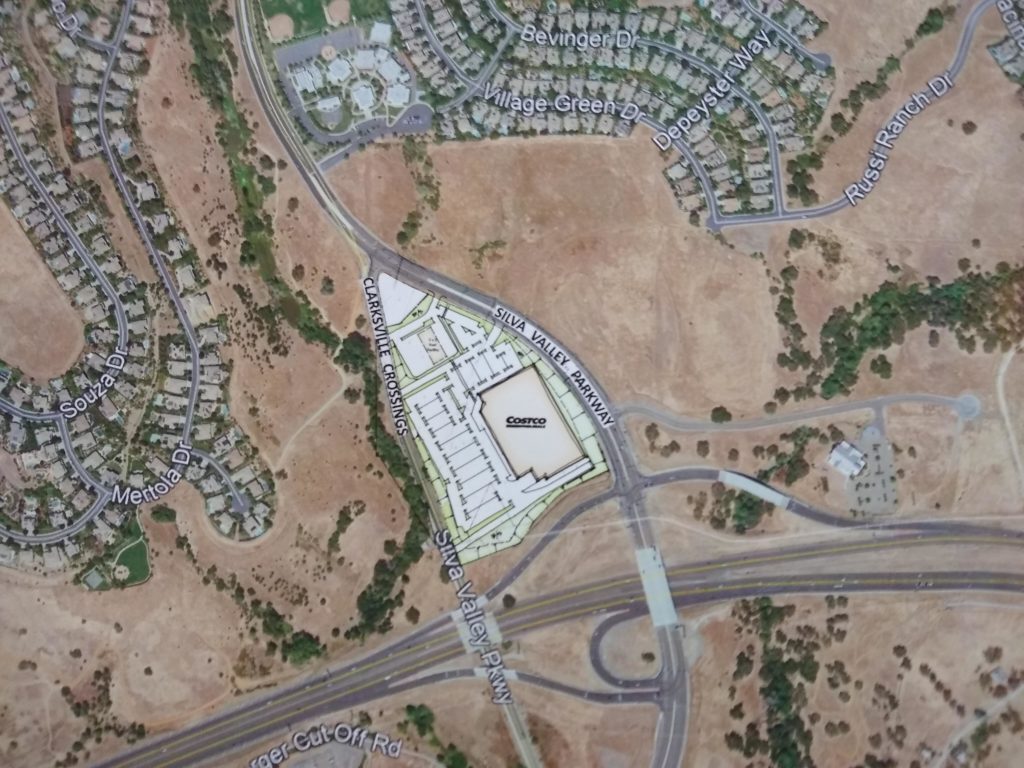
This project is proposed for the EDH52 commercially zoned property north of Highway 50 at Silva Valley Parkway and south of the proposed Country Club Drive extension to El Dorado Hills Boulevard. Suggestions have been made for parts of the projects on both the east and west sides of Silva Valley Parkway.
The latest project study shows a Costco Store located on the western side of Silva Valley Parkway including a fueling station. The entrances would be located on Silva Valley Parkway and Clarksville Crossing (Old Silva Valley Parkway) to the west. No formal application has yet been submitted as Costco is still weighing the possibility of an El Dorado Hills store.
The EDH52 commercial development submitted a conceptual design in 2017 that utilized both the eastern and western sides of the properties along Silva Valley Parkway that are south of Tong Road and north of Highway 50. This 2017 proposal was for upwards of 300,000 sq. ft. of commercial development and indicated the inclusion of a possible market, three gas stations, a 99 room hotel, and a self storage business.
With the possible sale of part of the property to Costco, the present plans for EDH52 will likely change significantly. Customers visiting these proposed businesses from the north end of Cameron Park and the western end of Rescue which is north of Bass Lake will have three options. They will undoubtedly use Bass Lake Road to access either Highway 50 west to Silva Valley Parkway; Bass Lake Road to the future Country Club Drive extension to Silva Valley Parkway; or Bass Lake Road to Serrano Parkway and Silva Valley Parkway.
Future School Sites
Rescue Union School District Sienna Ridge Road Site
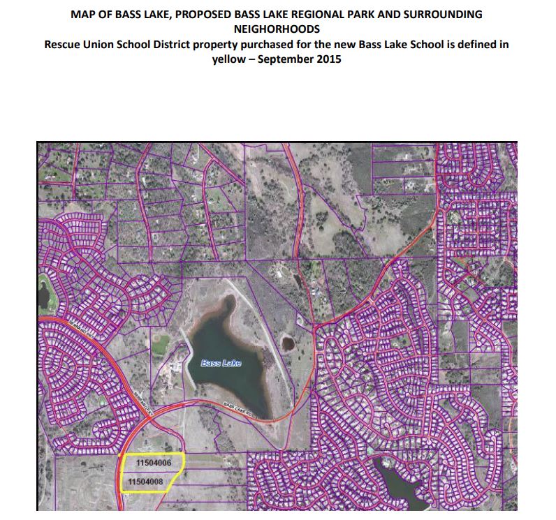
The school district purchased the 21 acre (two parcels) bordered by the Sienna Ridge Shopping Center to the north. Bass Lake Road is to the west of the site and the Bass Lake North Residential Development is to the east. It has been suggested as a K-8 school site.
Buckeye Union School District Silver Dove Way School Site
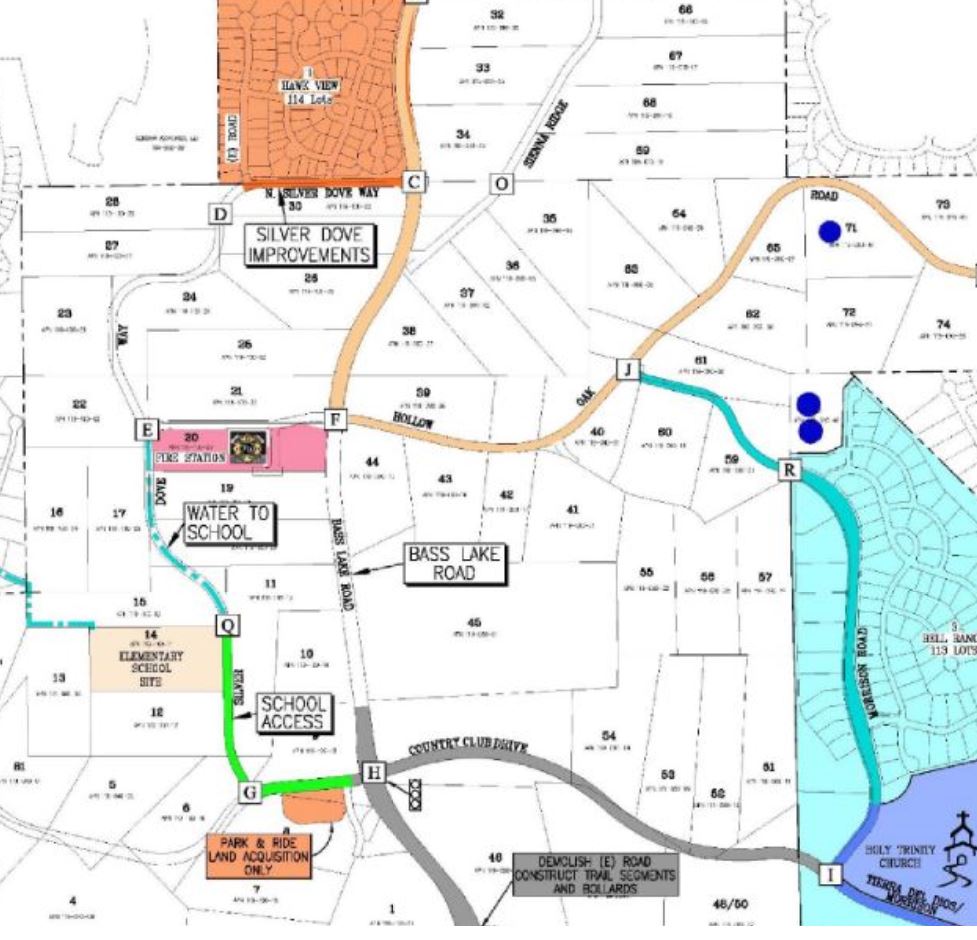
This school site is on Silver Dove Way and expected to serve residents in parts of the Bass Lake Hills Specific Plan (Bell Ranch and Bell Woods), Serrano Village C2, and the proposed Village of Marble Valley Specific Plan which will be a 4000 home project south of Highway 50 at Bass Lake Road.
El Dorado Union High School District
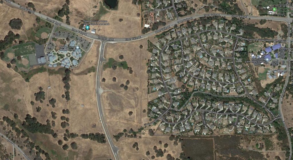
The El Dorado Union High School District owns unused and undeveloped property adjacent to Pleasant Grove Middle School along Silver Springs Parkway intended for possible a future High School Site.


