Analysis suggests that anticipated traffic volume increases have not materialized after 15 years.
A El Dorado County Land Use and Dev Services Public Notice has notified El Dorado County residents of a planned hearing before the County Planning Commission on April 14, 2022.
The County of El Dorado Planning Commission will hold a public hearing in the Planning Commission Hearing Room, 2850 Fairlane Court, Placerville, CA 95667 on April 14, 2022, at 8:30 a.m., to consider the following:
Tentative Subdivision Map Revision TM-R21-0001/Summer Brook submitted by BLUE MOUNTAIN COMMUNITIES, INC., request for a revision to the approved Summer Brook Tentative Map and Planned Development TM07-1440/PD07-0007 to remove Conditions of Approval No. 25, 27 and 28 requiring installation of a traffic signal and completion of, or financing for, associated intersection improvements prior to final map recordation. In lieu of a financial contribution, the applicant may instead propose the submittal of construction documents for the signal and which support construction by others once a signal warrant analysis justifies installation
Condition of approval #25 from the March 11, 2008 project approval by the County Board of Supervisors:
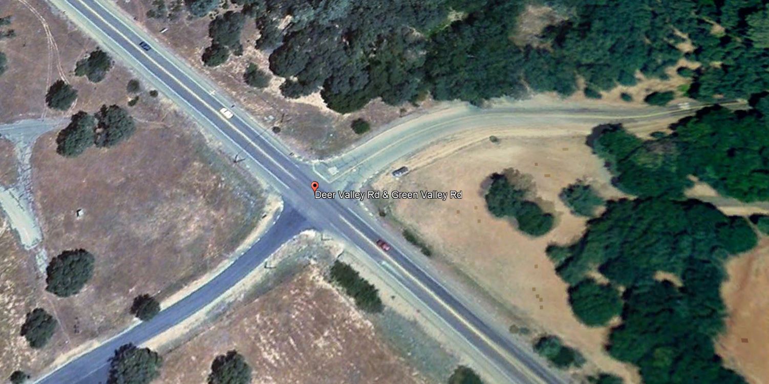
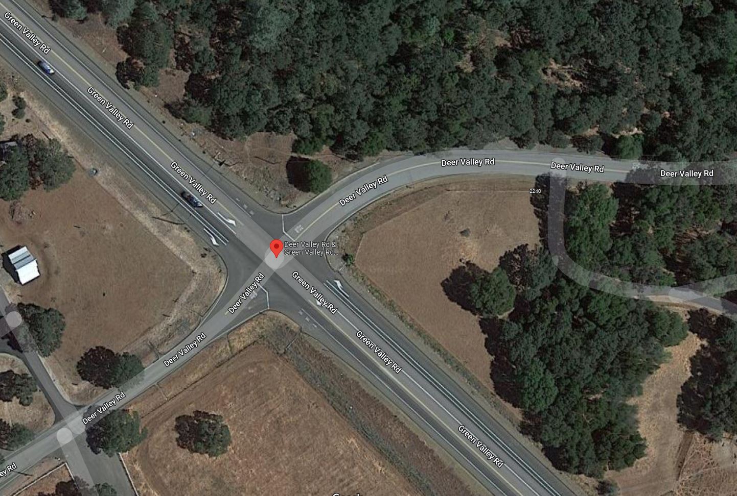
25. The applicant shall signalize the Green Valley/ Deer Valley Road intersection to meet current El Dorado County Standards, as required in the approved traffic study. These Required improvements shall include the geometric improvements to Green Valley Road consistent with the approved improvements plans for CIP Project No. 66114 which includes the intersection widening to provide for right and left tum channelization and acceleration/deceleration lanes and shall adhere to the latest version of the Manual Uniform Traffic Control Devices (MUTCD), the California Supplement, and the Caltrans Highway Design Manual. The improvements shall be substantially completed to the approval of the Department of Transportation or the applicant shall obtain an approved improvement agreement with security, prior to the filing the final map.
From the Applicant’s Application Packet to revise the project tentative map conditions of approval:
During the review of the Dixon Ranch project traffic analysis, County Staff discovered a change in the traffic warrant situation in the area. On August 16, 2018 Staff directed the applicant’s consulting engineer to reevaluate the traffic signal warrants associated the intersection of Green Valley and Deer Valley Roads. The applicant’s consulting engineer (Kimley Horn) completed a traffic signal warrant evaluation on March 28, 2019, updated June 4, 2021. Results of these analysis confirm that installation of a traffic signal at this location is not warranted at this time. Further, street improvements were recently completed at the subject intersection. This significantly improved the situation since the 2007 report. Please see attached traffic signal evaluation reports completed by Kimley Horn.
Because the traffic warrant for the signalization of the intersection is not satisfied, Staff directed the consulting engineer determined this project’s fair share contribution as part of the analysis. The applicant’s fair share has been calculated at 3.9%.Section 66498.2 of the California Subdivision Map Act allows for the amendment of a tentative map in the event of a change to an ordinance, policy, or standard. The required street widening improvements have been completed. The completion of these street improvements effectively satisfies the street improvement portion of the requirement.
In deciding if a traffic signal will be an asset rather than a potential liability, traffic engineers evaluate accepted warrants for traffic signals, in this case using the California Traffic Manual Uniform Traffic Control Devices. The installation of a traffic signal should be considered if one or more of the warrants in the referenced manual is met.
The decision to install a traffic signal should not be based solely upon the warrants, since the installation of a traffic signal may increase certain types of collisions, and increase delays to pedestrians, bicyclists and drivers who use the intersection. The California Manual on Uniform Control Devices criteria per the requirement were applied in the Kimley Horn analysis and warrants for the following were not met:
• Warrant 1: Eight-Hour Vehicular Volume
• Warrant 2: Four-Hour Vehicular Volume
• Warrant 3: Peak Hour
• Warrant 4: Pedestrian VolumesThe projected traffic volumes that would have warranted a traffic signal have not materialized. Although the standard has not changed, the standard has not been met as projected. In fact, the installation of a signal at this location could create an unsafe situation. At Staffs request an updated traffic warrant study was undertaken which resulted in warrants not being met. Because warrants have not been met, the applicant requests the tentative map be amended modifying Condition No. 25 to eliminate the installation of a signal by the applicant and require the applicant pay the project’s fair share cost of the signal.
Fair Share:
The Kimley Horn traffic signal warrant evaluation determined that the project’s fair share contribution to the signal is 3.90% or an estimated $10,000-$12,000. The applicant has contracted with Kimley Horn to design traffic signal construction plans for the intersection of Deer Valley /Green Valley. The plans will allow the traffic signal to be built at the time warrants are met. The applicant proposes that these plans be used to satisfy the project’s fair share of the signal costs. In fact, the actual contracted cost for the signal design ($17,000) exceeds the applicant’s fair share cost for the traffic signal.
Request:
Blue Mountain Communities requests modification to TM07-1440-R-2 Department of Transportation condition 25. Specifically, we request that Condition No. 25 be modified such that the applicant/owner be required to contribute its fair share to the subject traffic improvements as detailed in the traffic signal warrant evaluations prepared by Kimley Horn and attached hereto. Further, its is requested that the traffic signal design plans being prepared by Kimley Horn for Blue Mountain Communities serve as Blue Mountain’s fair share contribution.
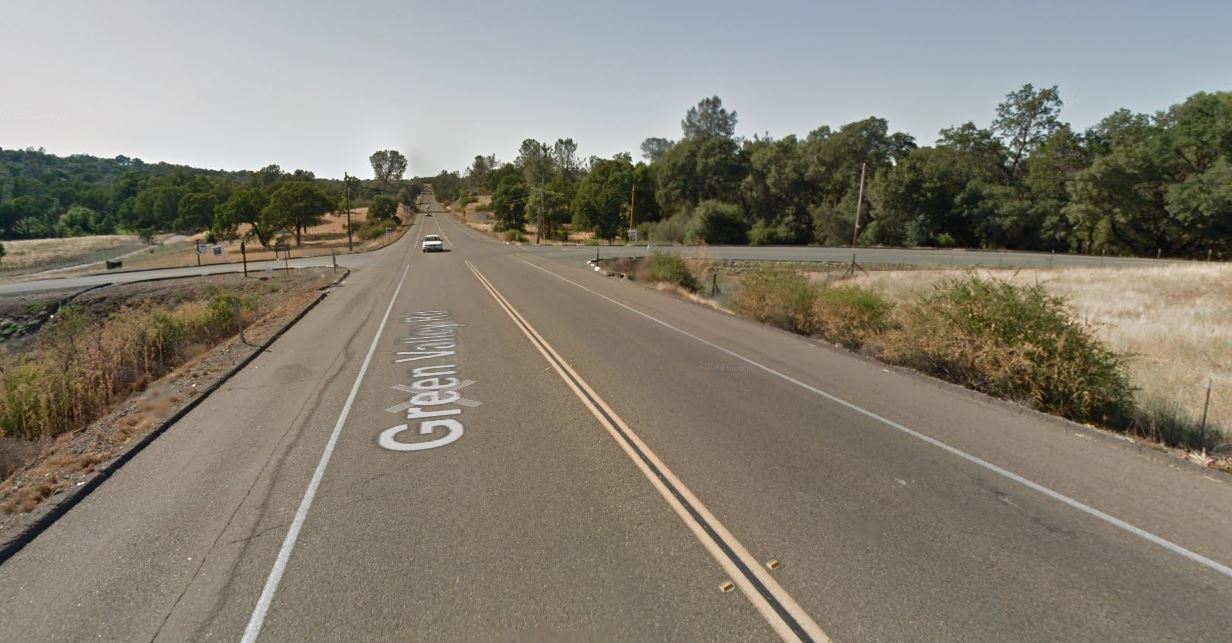
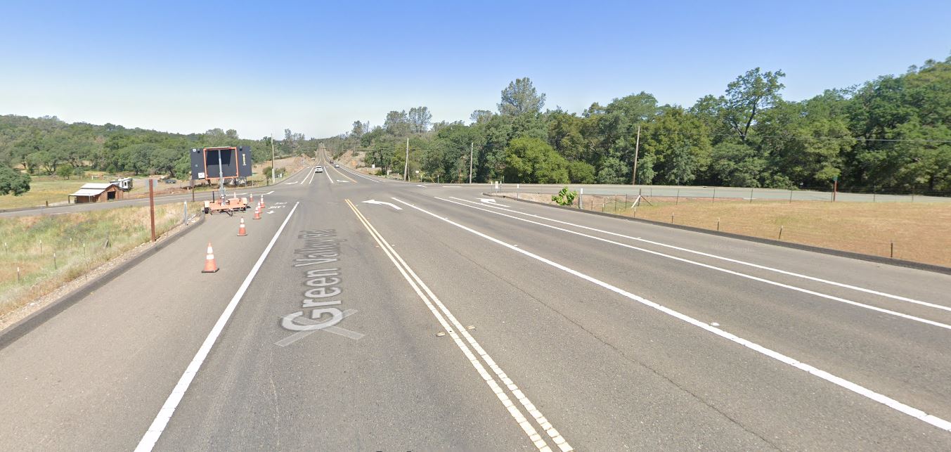
Improvements to the Green Valley Road – Deer Valley Road intersection were completed in 2014 along with the addition of the Green Valley Road – Silver Springs Parkway Intersection/signalization project, conditioned by the approval of the Silver Springs residential development , which satisfied elements of CIP Project No. 66114 which included the intersection widening to provide for right and left tum channelization and acceleration/deceleration lanes.
Blue Mountain Communities purchased the Summer Brook property in 2021, and are currently developing the approved 29 residential lots. They also purchased the Silver Springs property across Green Valley Road in 2018, and are currently developing 37 homes in phase 1 of the Revere at Silver Springs project.
Over-optimistic growth/planning projections, and road improvements lost
Bass Lake Area residents in Rescue, Cameron Park, and El Dorado Hills, will notice a pattern – planned and promised road and pedestrian circulation and safety improvements, conditioned by multiple development applications from over 30 to 20 years ago, being delayed or removed from the County’s list of projects, primarily based on inaccurate analysis and projections from the late 1980s, the 1990s, and the 2000 – 2015 era. Frustratingly for area residents is that the analysis of multiple development projects resulted in findings regarding impacts on our communities from twenty, and even thirty-plus years ago had provided the blueprint for the growth of the Bass Lake Area, but the analysis, findings, and mitigations continue to unravel. Multiple projects over those many years were approved with the assumptions of cumulative impacts between them all, and intertwined conditions of approval. Recent analysis of these projects as they are revisited have led to many improvement projects disappearing from the planning horizon:
- The removal of CIP projects for constructing a four lane Bass Lake Road in 2015, and 2016
- The removal of frontage improvements (Sidewalks, turn pockets, and bicycle lanes) for Bass Lake Road provided by specific projects in the 1988 El Dorado Hills Specific Plan, as those projects were updated in 2017 and 2019
- Removal of planned elements of Bass Lake Road improvements included in the 1996 Bass Lake Hills Specific Plan, in 2016-17.
- Removal of four lane Bass Lake Road improvements from US50 to Serrano Parkway attributed to a finding that Bass Lake Road from the re-aligned Country Club Drive north to Serrano Parkway exists in the El Dorado Hills Community Region, and Bass Lake Road from Country Club Drive south to US50 exists in the County Rural Region in 2019-20 – Level of Service (LOS) metrics/triggers differ between community and rural regions.
Public Comments regarding TM-R21-0001
If you would like to provide public comments to the Planning Commission prior to the April 14, 2022 hearing, you can submit fact based informed comments to planning@edcgov.us . Remember, emotion is not part of the deliberative process of the Planning Commission, so respectful comments, related to your concerns or questions, make for the most productive discussion.
Notice of Public Hearing
 Loading...